Boulder County Communities
Towns and Town Histories
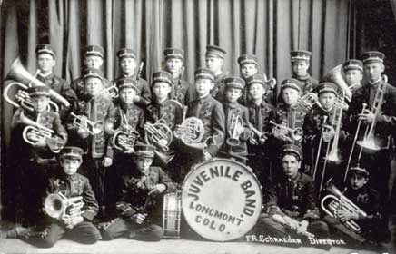
Photo in private collection of Pauli Driver Smith.
| TOWN | HISTORY | TODAY |
| Allenspark | Est. 1896; named for Alonzo N. Allen who discovered gold nearby in 1864; stage stop bet. Ward and Estes Park | Community, 2000 population 496 |
| Altona | Originally called Modoc (1874-79), Altona was a post office [Peter Haldi Postmaster] and business point near mouth of Left Hand Canyon until 1916. Occupants: George Bader and Samuel Arbutnot, pioneers. Search for Arbutnot Surname. Elevation: 5599 ft., latitude: 400802N, longitude: 1051656W | Ghost town |
| Balarat | Post Office (1879-1887) - Community. Elevation 7480 ft., latitude: 400933N, longitude: 1052345W | Ghost town |
| Big Five | Present day:
|
Ghost town |
| Boulder | Early history (source unknown): "First called Boulder City. Elevation 5,535 ft. County seat of Boulder County, located near foothills, in North Boulder Valley on Boulder Creek. In 1871 population was 600, 1873-750, 1875-2,100, 1877, 4,000. Boulder is the County seat and the home of the University of Colorado. The population has grown to 94,673 (2000 US Census). | County seat; home of the University of Colorado; population in the year 2000 - 94,673 |
| Canfield | Post office 1878-1906; station on D&BV railroad 1¼ miles west of Erie; latitude: 400313N, longitude: 1050427W | Ghost town |
| Cardinal | Once a wagon stop mining camp on the Coon Trail established in 1870 by Sam Conger and surveyed by J. D. Peregrine. There was a post office, assay office, boarding house, saloons, and several stores. In 1872 the population was 1872 [?] and increased to 1,500 between 1878 and 1883. A post office from 1905-1919. Elevation - 8980; latitude: 395811N longitude: 1053250W. | Ghost town |
| Caribou | Ghost town | |
| Copperock | Post Office 1892-1915 | Ghost town |
| Crisman | Post Office 1876-1918; elevation 6360 ft.; latitude: 400227N; longitude: 1052139W | Ghost town |
| Davidson | Post Office 1873-1878 Station on C.C.R.R. 8 miles from Boulder. Davison Coal and Iron Co. and Escelior Coal Co.; Robert Smith, general merchandise; W.A. Davison, coal; J.E. Jones, hotel. |
Ghost town |
| Delphi | Post Office 1895-1898 . . . see Wallstreet | |
| Eagle Rock (aka Eagle Creek) | Mining camp [hotel, M.
Boneber] Mines: Equator, Melbourne, Paymaster, Milan,
Little Belle, Wheeling, Whole, Golden Eagle, Lone
Star. Post Office 1876-1877 |
Abandoned |
| Eldora | Est. 1897, Inc. 1898; previously known as Eldorado; elevation - 8641 ft.; latitude: 395655N; longitude: 1053348W. | Community |
| Eldorado Springs | Est. 1930; previously known as Hawthorne; elevation - 5762 ft.; latitude: 395557N; longitude: 1051635W. | Community; 2000 population 557 |
| Erie | Straddles the Boulder/Weld County line.
Original townsite was in Weld County. |
|
| Gold Hill | Community; 2000 population 210 | |
| Gorham | Post Office 1899-1942 (see also Marshall) | Renamed |
| Gresham | Post Office 1895-1912; elevation 8444 ft., latitude: 400825N, longitude: 1052554W | Ghost town |
| Highland | RR Stop 1892-1959 map; elevation 5136 ft., latitude: 401420N, longitude: 1050458W | Community |
| Hygiene | (Previously called Pella, North Pella) Established in 1861; Post Office established 1883; Reverend Jacob S. Flory built Hygiene, was the first postmaster and first publisher. Elevation 5097 ft., latitude: 401119N, longitude: 1051049W | Community |
| Jamestown | (Previously called Camp Jimtown, Jimtown; aka Elysian Park) Est. 1867, Inc 1883. Early history (source unknown): "One of oldest mining towns in Colorado on James creek, 5 miles northeast of Gold Hill, 8 east of Ward, 10 northwest of Boulder. Population 700, with stores, saloons, not merely a community. Peabody Mineral Springs: hotel and baths, C.F. Pease; Morley & Co., general merchandise; Willard Mills." Elevation 6929 ft., latitude: 400656N, longitude: 1052317W | Community; 2000 population: 205 |
| Keysport | Early (source unknown): "1870 Keysport was on Beaver creek, in Grand Island district, Boulder county, 2 miles from Caribou, 16 miles from Central, and 18 miles from Boulder City. [names: Alfred Tucker, E. Sexton, John Anderson, JS Beaman, J. W. Daniels, Henry Deschner]." | Ghost town |
| Lafayette | Est. 1889, Inc 1890, founded by Mary Miller and named for her husband Lafayette Miller | Community, 2000 population 23,197 |
| Liggett | RR Stop-1969 map; elevation 5059 ft., latitude: 400242N, longitude: 1050800W | Ghost town |
| Longmont | Early history (source unknown): "Next to Boulder City, the principal town in Boulder county. Terminus of the Colorado Central R.R., Julesburg Division. Daily mail and express. Western Union and Atlantic and Pacific Telegraph Lines. Tri-weekly stages to la Porte, Ft. Collins, and Cheyenne; daily to Erie. Population, 800. Distances: To Evans or Greeley, 30 miles; Erie, 10; Long's Peak, 30; Estes Park, 32." Est. 1871, Inc 1873; elevation 4942 ft. | Community; 2000 population 71,093 |
| Louisville | As found on Boulder County Almanac, "The city's roots can be traced back to coal mining in 1877. The town was founded in 1878 when Louis Nawatny platted his farmland into city blocks and named the community after himself. Thirty mines eventually opened." Elevation 5337 ft. | Community; 2000 population 18,937 |
| Lyons | Early (source unknown): "Coal mining town and trading point for farmers on the Colorado Central Railroad. 12 miles from Boulder. [CC Welch, Jay Gould, David Kerr, G. W. Eggleston, James Minks.]" Mining Camp as early as 1858; Est. 1882; Inc 1891; elevation 5362 ft. | Community; 2000 population 1,585 |
| Magnolia | Early (source unknown): "Center of a new mining district in Boulder county, 10 miles from Boulder City. Principal lodes: Magnolia, Alabama, Riter, Downs, Keystone, Atlantic, Little Darrt, Jefferson, Dunraven, Queen Victoria." Post Office, 1876-1920; elevation 7238 ft.; latitude: 395938N; longitude: 1052153W. | Community |
| Marshall | Early (source unknown): "Old-mining town with post office, 5 miles southerly of Boulder. Developed by Joseph W. Marshall, William L. Lee, Mylo Lee and AG Langford." Est. 1860-1878; elevation 5509 ft.; latitude: 395720N; longitude: 1051345W | Community |
| Nederland | Early (source unknown): "Called Brownville in 1870, in 1875 the name changed to Nederland. Also called Middle Boulder, on the road between Boulder City and Caribou, and at the forks of the road to Central. Daily mails and express. Western Union Telegraph. Daily stages to Central, Caribou and Boulder. Population 500. Principal mines: Lone Star, First National, Boulder County, Trogan and Washington Avenue lodes. Distance to Caribou, 4 miles; to Boulder, 16; to Central, 15." Est. 1871, Inc 1874 (some sources say inc. 1859); additional variant name: Tungsten Town; elevation 8233; latitude: 395741N; longitude: 1053037W | Community; 2000 population 1,394 |
| New Market | Ghost town | |
| Niwot
|
Early (source unknown): "Settlers claimed lands as early as 1859, but the town was not established until 1872. 'Ni-Wot' is named for the leader of a band of Arapaho Indians, Chief Ni-Wot, meaning left handed. He is said to have evoked a curse--that those who came to winter here, even if they subsequently left would always be lured back. The curse is legend. The lure is real. Niwot's location, 4 miles from Boulder, below the Front range is in a calm weather pattern, snow will fall on both sides and miss Niwot. [settlers: P T Hinman, his P M Hinman and W Caywood & Sons, and Sylvanus Budd. On the Colorado Central Railroad.]" Post Office established 1873; RR station 1875. | Community; 2000 population 4,160 |
| Orodelfan | Post Office 1876-1881, also called: Orodell, Maxwell's Mill, Hortonville, Hunt's Concentration Works | Ghost town |
| Pella | Original townsite located near present day Hygiene | Ghost town |
| Rowena | Est. 1894; Post Office PO 1894-1918; elevation 7372 ft.; latitude: 400437N; longitude: 1052320W | Community |
| Salina | Early (source unknown): "Mining town in Boulder county. Daily stages to Boulder, Gold Hill and Sunshine. Population 100. Reduction Works. H. G.. Sartore, general merchandise." Post Office 1874-1925; elevation 6581 ft. | Community |
| Santa La Saria | Latitude 395746N; longitude 1053034W | Ghost town/Inactive mine |
| Sugar Loaf | Early (source unknown): "Mining district in Boulder county, 10 miles west of Boulder." Post Office 1867-1944; elevation 7842 ft.; latitude: 400101N; longitude: 1052424W | Community |
| Sunshine | Early (source unknown): "The mining town in the eastern limits of Gold Hill mining district, in the foot hills, at the elevation of about 6,700 feet above sea level, six miles from Boulder City. Daily mails, express and stages to Boulder. Population, 800. An excellent newspaper, the Sunshine Courier, Bruner & Cairus, publishers, is printed here, and has done much to advertise this rich mining section. Distances: Boulder, 6 miles, Denver, 40; Gold Hill, 2 ½; Salina, 1; Jamestown, 8; Caribou, 16; Central City, 35." Post Office 1875-1913, Inc 1885; elevation 7160 ft.; latitude: 400357N; longitude: 1052158W | Community |
| Superior | Est. 1896, Inc 1904; elevation 5490 ft.; population in 1990 was 255; in 2000 it was 9011 | Community |
| Tungsten | Post Office 1916-1949; reached a peak population of 20,000; elevation 8002; latitude: 395819N; longitude: 1052832W | Ghost town |
| Valmont | Early (source unknown): "On the Denver & Boulder Valley Railroad, one mile from Colorado Central. Daily mail and express. WU Telegraph line. Population 500. Distances: to Boulder 3½ miles, Erie 9, Davidson 4½." Post Office 1865-1901; elevation 5183 ft.; latitude: 400155N; longitude: 1051250W | Community |
| Wallstreet | Originally named Delphi; name changed in 1898; Post Office 1895-1921; elevation 6878 ft.; latitude: Photos | Ghost town |
| Ward | Early (source unknown): "1867-Population 1000, 8 miles north of Caribou and 6 milesabove Gold Hill. Population 400. Smith's Hotel, Ni-Wot Mill of fifty stamps; the Baxter, Long & Ulverson, Weist's Snider, Sivyer, J. Ellingham & Co., Ward Mining Co.'s stamp mills. Mines: Columbia, Celestial, Neillson and Humbold." Est. 1863 as Ward District; renamed Ward 1894, Inc 1896; elevation 9160 ft. | Community, 2000 population 169 |
This page was updated on Nov 26, 2011
Some information on these pages bear the personal copyright of individuals. Please respect their copyright. No copyrighted information found on any page within this website may be used for commercial purposes without the express permission of the copyright owner. This website also contains public domain data and data that is common property and containing no original authorship (i.e. old time lists and tombstone information, etc) and is not copyrighted. Links to external web sites are being provided as a convenience and for informational purposes only; they do not constitute an endorsement or approval of any of the products, services or opinions contained in any external web site.