Boulder County Maps
Historic maps are a valuable resource. They show the locations of towns, communities, and villages that are no longer in existance, give you a sense of how things have changed over the centuries, and help you place in time and space where your family migrated from point "A" to point "B."
Most of the maps shown here are courtesy of the late Lee Zion. Lee spent many months, and perhaps years, locating, scanning maps, and uploading them to the USGenWeb archives. you can find many of his maps, including those of other Colorado counties in the archives at: www.usgwarchives.net/maps/colorado/
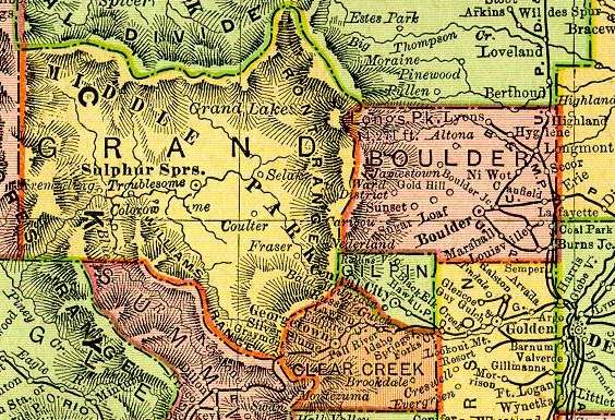
1895 Rand McNally Railroad Atlas
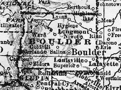
of the United States1905
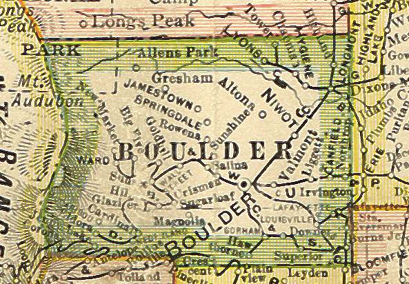
Untitled School Map1920
This page was updated on July 21, 2011
Some information on these pages bear the personal copyright of individuals. Please respect their copyright. No copyrighted information found on any page within this website may be used for commercial purposes without the express permission of the copyright owner. This website also contains public domain data and data that is common property and containing no original authorship (i.e. old time lists and tombstone information, etc) and is not copyrighted. Links to external web sites are being provided as a convenience and for informational purposes only; they do not constitute an endorsement or approval of any of the products, services or opinions contained in any external web site.